Ross Valley Fire News
Creek Gauge Installed on Sleepy Hollow Creek
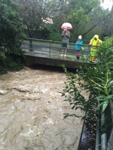
A creek level gauge has been installed on Sleepy Hollow Creek at Fire Station 20, 150 Butterfield Road. This gauge, like the ones at Fairfax Fire Station 21 and downtown San Anselmo, provides supplemental data regarding runoff and creek flow. This data is made available to the public on the Ross Valley Fire Department "Creek Levels and Weather" web-page. Sleepy Hollow Creek is a significant tributary of San Anselmo Creek, and is the primary source of water for several neighborhoods that experience flooding duiring significant runoff events, including Sleepy Hollow, the Alameda, and the Morningside neighborhood.
The data and information on these plots is raw, unrefined, and has not been verified. The plots come directly from the monitoring equipment and are displayed in unedited format. All monitoring equipment is subject to intermittent fluctuations, or spikes, which may cause invalid readings. These plots are updated every 15 minutes and may not reflect current levels. The data and information is subject to change at any time for a variety of reasons, and should not be relied upon as a sole source for making decisions regarding life safety or property protection.
Threshold and critical water levels have not been determined for the Sleepy Hollow location at this time.
Sleepy Hollow Creek Level
The chart is updated every 15 minutes. Gauge is located at 150 Butterfield Rd.
Critical level: TBD
Current Creek Depth, Sleepy Hollow (pop up) (Raw Data)

